
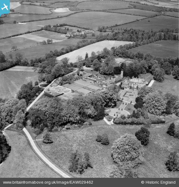
EAW029462 ENGLAND (1950). Malshanger House and surrounding countryside, Oakley, 1950
© Copyright OpenStreetMap contributors and licensed by the OpenStreetMap Foundation. 2026. Cartography is licensed as CC BY-SA.
Nearby Images (10)
EAW029462

EAW029468

EAW029463

EAW029464

EAW029467

EAW029465

EAW029461

EAW029466

EAW029469

EAW029460

Details
| Title | [EAW029462] Malshanger House and surrounding countryside, Oakley, 1950 |
| Reference | EAW029462 |
| Date | 12-May-1950 |
| Link | |
| Place name | OAKLEY |
| Parish | OAKLEY |
| District | |
| Country | ENGLAND |
| Easting / Northing | 456743, 152556 |
| Longitude / Latitude | -1.1865520214959, 51.268818376508 |
| National Grid Reference | SU567526 |
Pins
Be the first to add a comment to this image!