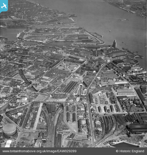
EAW029289 ENGLAND (1950). Hamilton Square and environs, Birkenhead, 1950
    © Copyright OpenStreetMap contributors and licensed by the OpenStreetMap Foundation. 2025. Cartography is licensed as CC BY-SA.
  
Nearby Images (9)
Details
| Title | [EAW029289] Hamilton Square and environs, Birkenhead, 1950 | 
| Reference | EAW029289 | 
| Date | 11-May-1950 | 
| Link | |
| Place name | BIRKENHEAD | 
| Parish | |
| District | |
| Country | ENGLAND | 
| Easting / Northing | 332564, 388911 | 
| Longitude / Latitude | -3.0141844302555, 53.392459777581 | 
| National Grid Reference | SJ326889 | 
Pins
|  Leicester Street prefabs, UK100 type |   Post-war prefabs | Thursday 12th of August 2021 12:24:35 PM | 
|  What's this - looks like an uncharted tunnel mouth, it is fenced-off from Lairds and the railway companies sidings..? |   Pete65 | Tuesday 24th of May 2016 12:37:17 AM | 
|  The Swinging Arm Pub |   Secondtomes | Wednesday 18th of February 2015 06:29:11 PM | 
|  St Mary's Gate |   Secondtomes | Wednesday 18th of February 2015 06:10:10 PM | 
|  St Mary's Gate |   Secondtomes | Wednesday 18th of February 2015 06:10:06 PM | 
|  New Chester Road |   Secondtomes | Wednesday 18th of February 2015 06:01:55 PM | 
|  Egerton Street, Birkenhead |   Secondtomes | Wednesday 18th of February 2015 06:00:35 PM | 
|  Tunnel Road, Birkenhead |   Secondtomes | Wednesday 18th of February 2015 05:59:28 PM | 
|  Brook Street signal box |   beast66606 | Tuesday 4th of March 2014 08:45:10 PM | 
|  Canning Street North signal box |   beast66606 | Tuesday 4th of March 2014 08:44:30 PM | 
|  Birkenhead Woodside signal box |   beast66606 | Tuesday 4th of March 2014 08:43:34 PM | 
User Comment Contributions
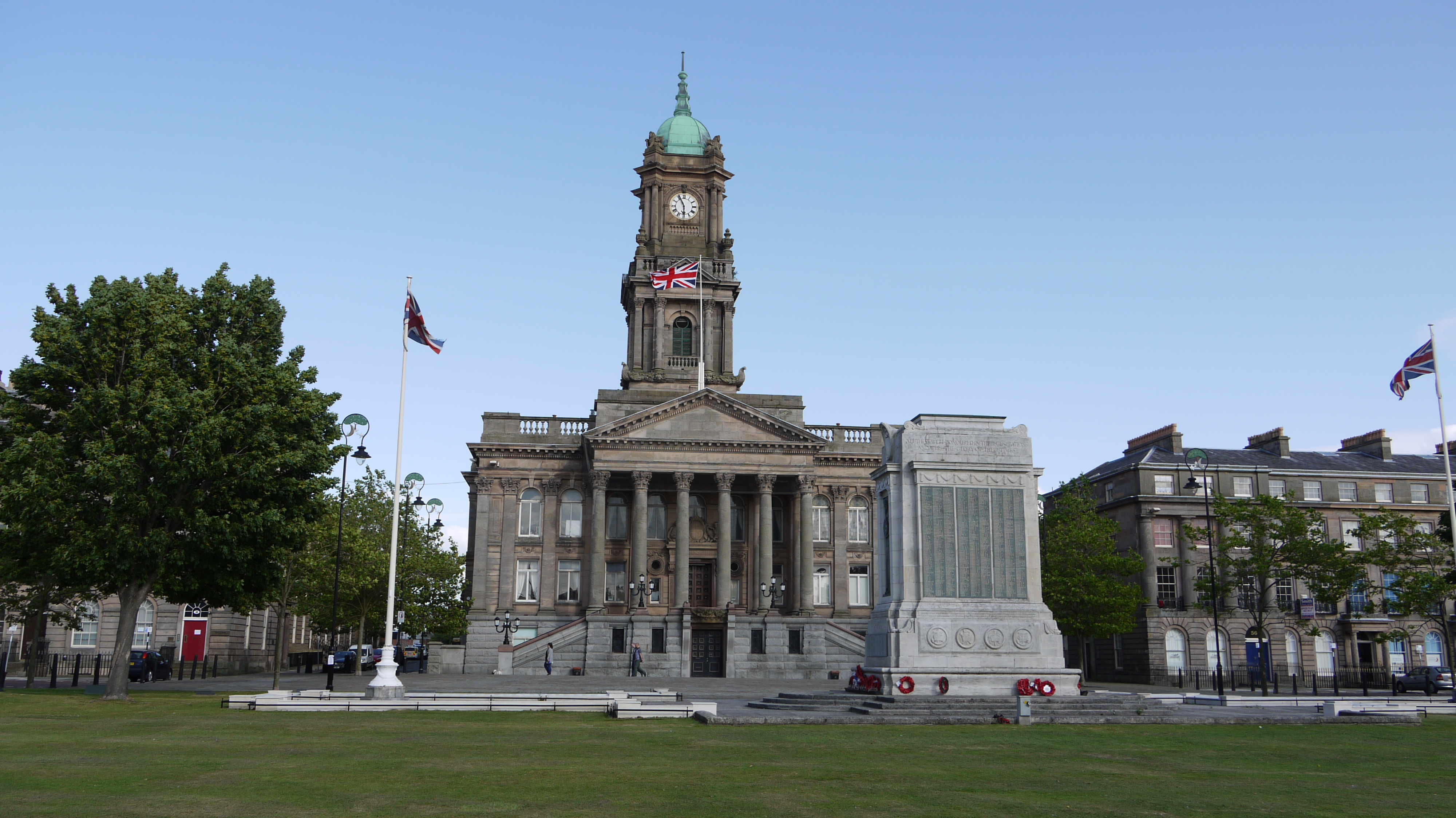
| Birkenhead Town Hall & War Memorial, 17/07/2015 | Class31 | Saturday 8th of August 2015 07:20:56 AM | 
 
             
  ![[EAW029289] Hamilton Square and environs, Birkenhead, 1950](http://britainfromabove.org.uk/sites/all/libraries/aerofilms-images/public/100x100/EAW/029/EAW029289.jpg) 
  
                                          ![[EAW029287] Hamilton Street and environs, Birkenhead, 1950](http://britainfromabove.org.uk/sites/all/libraries/aerofilms-images/public/100x100/EAW/029/EAW029287.jpg) 
 ![[EAW029288] Hamilton Square and environs, Birkenhead, 1950](http://britainfromabove.org.uk/sites/all/libraries/aerofilms-images/public/100x100/EAW/029/EAW029288.jpg) 
 ![[EAW001721] King's Square and entrance to the Mersey Tunnel, Birkenhead, 1946](http://britainfromabove.org.uk/sites/all/libraries/aerofilms-images/public/100x100/EAW/001/EAW001721.jpg) 
 ![[EPW045191] Preparations for the opening of the Queensway Tunnel, Hamilton Square and environs, Birkenhead, 1934](http://britainfromabove.org.uk/sites/all/libraries/aerofilms-images/public/100x100/EPW/045/EPW045191.jpg) 
 ![[EAW001722] King's Square and entrance to the Mersey Tunnel, Birkenhead, 1946](http://britainfromabove.org.uk/sites/all/libraries/aerofilms-images/public/100x100/EAW/001/EAW001722.jpg) 
 ![[EPW045190] Hamilton Square, the entrance to the Queensway Tunnel and environs, Birkenhead, 1934](http://britainfromabove.org.uk/sites/all/libraries/aerofilms-images/public/100x100/EPW/045/EPW045190.jpg) 
 ![[EAW001807] Hamilton Square, Woodside Ferry and environs, Birkenhead, 1946](http://britainfromabove.org.uk/sites/all/libraries/aerofilms-images/public/100x100/EAW/001/EAW001807.jpg) 
 ![[EAW029290] The town and docks, Birkenhead, from the south-east, 1950](http://britainfromabove.org.uk/sites/all/libraries/aerofilms-images/public/100x100/EAW/029/EAW029290.jpg)