
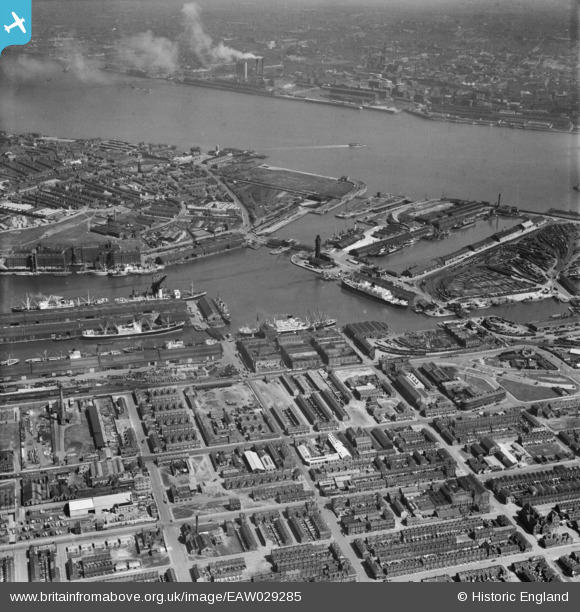
EAW029285 ENGLAND (1950). The East Float and the Docks, Birkenhead, from the south-west, 1950
© Copyright OpenStreetMap contributors and licensed by the OpenStreetMap Foundation. 2026. Cartography is licensed as CC BY-SA.
Nearby Images (2)
EAW029285

EAW051424

Details
| Title | [EAW029285] The East Float and the Docks, Birkenhead, from the south-west, 1950 |
| Reference | EAW029285 |
| Date | 11-May-1950 |
| Link | |
| Place name | BIRKENHEAD |
| Parish | |
| District | |
| Country | ENGLAND |
| Easting / Northing | 331714, 389602 |
| Longitude / Latitude | -3.0271150648186, 53.398561352624 |
| National Grid Reference | SJ317896 |
Pins

mealeyi |
Monday 29th of December 2025 02:38:41 PM | |
|
dd |
Friday 20th of March 2020 11:48:39 AM | |
|
dd |
Friday 20th of March 2020 11:47:37 AM | |
|
dd |
Friday 20th of March 2020 11:45:26 AM | |
|
Jess |
Sunday 17th of May 2015 11:45:45 AM | |
|
beast66606 |
Tuesday 4th of March 2014 08:49:01 PM | |
|
Pete65 |
Sunday 23rd of February 2014 04:05:57 AM |