
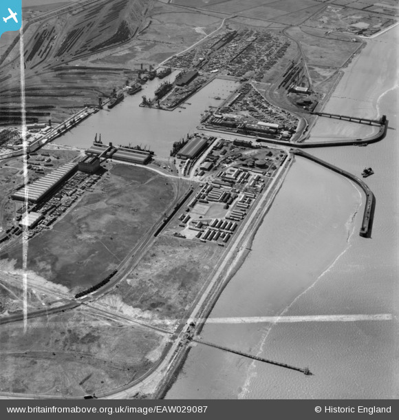
EAW029087 ENGLAND (1950). Immingham Dock, Immingham, 1950. image was marked by Aerofilms Ltd for photo editing.
© Copyright OpenStreetMap contributors and licensed by the OpenStreetMap Foundation. 2026. Cartography is licensed as CC BY-SA.
Nearby Images (2)
EAW029087

EAW029085

Details
| Title | [EAW029087] Immingham Dock, Immingham, 1950. image was marked by Aerofilms Ltd for photo editing. |
| Reference | EAW029087 |
| Date | 10-May-1950 |
| Link | |
| Place name | IMMINGHAM |
| Parish | IMMINGHAM |
| District | |
| Country | ENGLAND |
| Easting / Northing | 520177, 416101 |
| Longitude / Latitude | -0.18254675268434, 53.627391829715 |
| National Grid Reference | TA202161 |
Pins

Matt Aldred edob.mattaldred.com |
Saturday 27th of February 2021 11:49:02 AM | |

redmist |
Saturday 23rd of February 2019 10:48:44 PM | |
|
redmist |
Saturday 23rd of February 2019 10:47:38 PM | |

Class31 |
Monday 31st of March 2014 04:47:00 PM |