
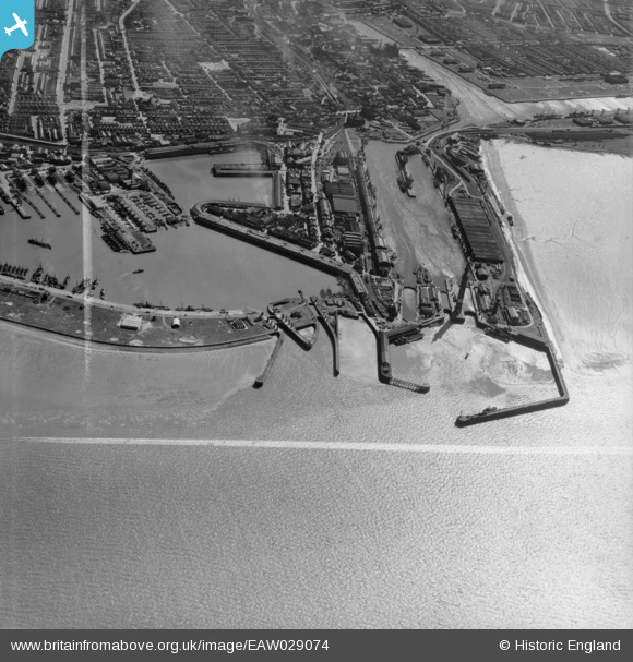
EAW029074 ENGLAND (1950). The Royal Dock, Tidal Basin and Fish Docks, Grimsby, 1950. This image was marked by Aerofilms Ltd for photo editing.
© Copyright OpenStreetMap contributors and licensed by the OpenStreetMap Foundation. 2026. Cartography is licensed as CC BY-SA.
Nearby Images (17)
EAW029074

EAW029067

EAW029410

EAW029077

EAW029072

EAW029068

EAW029014

EAW029407

EAW029406

EAW029075

EAW029404

EPW012666

EAW029073

EAW029405

EPW053397

EPW012668

EAW029411

Details
| Title | [EAW029074] The Royal Dock, Tidal Basin and Fish Docks, Grimsby, 1950. This image was marked by Aerofilms Ltd for photo editing. |
| Reference | EAW029074 |
| Date | 10-May-1950 |
| Link | |
| Place name | GRIMSBY |
| Parish | |
| District | |
| Country | ENGLAND |
| Easting / Northing | 528082, 411291 |
| Longitude / Latitude | -0.065047976398982, 53.582303749799 |
| National Grid Reference | TA281113 |
Pins

Matt Aldred edob.mattaldred.com |
Saturday 27th of February 2021 11:34:42 AM | |

redmist |
Wednesday 31st of October 2018 09:19:15 PM | |

Class31 |
Monday 3rd of March 2014 07:41:29 PM | |
|
Class31 |
Monday 3rd of March 2014 04:57:58 PM |