
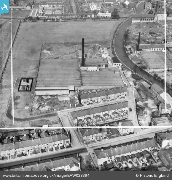
EAW028394 ENGLAND (1950). The Prospect Cotton Mill, Clayton-Le-Moors, 1950. This image was marked by Aerofilms Ltd for photo editing.
© Copyright OpenStreetMap contributors and licensed by the OpenStreetMap Foundation. 2026. Cartography is licensed as CC BY-SA.
Nearby Images (8)
EAW028394

EAW028400

EAW028395

EAW028397

EAW028399

EAW028398

EAW028401

EAW028396

Details
| Title | [EAW028394] The Prospect Cotton Mill, Clayton-Le-Moors, 1950. This image was marked by Aerofilms Ltd for photo editing. |
| Reference | EAW028394 |
| Date | 25-March-1950 |
| Link | |
| Place name | CLAYTON-LE-MOORS |
| Parish | |
| District | |
| Country | ENGLAND |
| Easting / Northing | 374705, 430507 |
| Longitude / Latitude | -2.383817490604, 53.770073000349 |
| National Grid Reference | SD747305 |
Pins

Matt Aldred edob.mattaldred.com |
Sunday 2nd of March 2025 04:39:07 PM | |
|
Matt Aldred edob.mattaldred.com |
Sunday 2nd of March 2025 04:38:40 PM |