
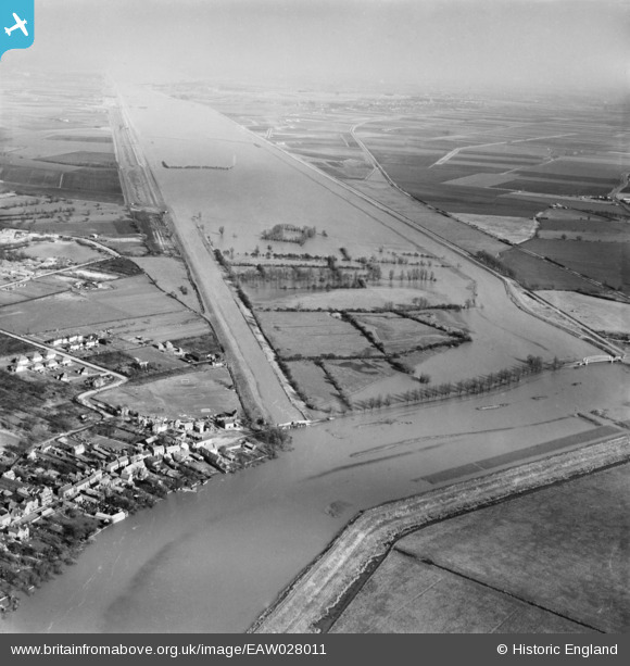
EAW028011 ENGLAND (1950). The New Bedford River, Earith, from the south-west, 1950
© Copyright OpenStreetMap contributors and licensed by the OpenStreetMap Foundation. 2025. Cartography is licensed as CC BY-SA.
Nearby Images (3)
EAW028011

EAW028010

EAW028012

Details
| Title | [EAW028011] The New Bedford River, Earith, from the south-west, 1950 |
| Reference | EAW028011 |
| Date | 17-February-1950 |
| Link | |
| Place name | EARITH |
| Parish | EARITH |
| District | |
| Country | ENGLAND |
| Easting / Northing | 538920, 274839 |
| Longitude / Latitude | 0.039997288977858, 52.353605002889 |
| National Grid Reference | TL389748 |
Pins

Matt Aldred edob.mattaldred.com |
Saturday 21st of June 2025 05:30:14 PM | |
|
Matt Aldred edob.mattaldred.com |
Saturday 21st of June 2025 05:29:40 PM | |

Peter |
Tuesday 19th of June 2018 07:57:17 AM | |
|
Peter |
Tuesday 19th of June 2018 07:56:33 AM | |
|
Peter |
Tuesday 19th of June 2018 07:52:49 AM |