
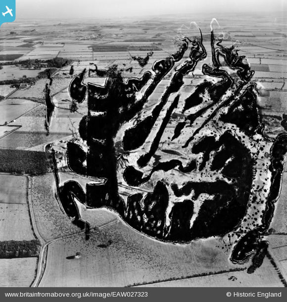
EAW027323 ENGLAND (1949). The Brenkley Opencast Coal Mining Workings (site of), Brenkley, from the west, 1949. This image has been produced from a damaged negative.
© Copyright OpenStreetMap contributors and licensed by the OpenStreetMap Foundation. 2026. Cartography is licensed as CC BY-SA.
Nearby Images (2)
EAW027323
, Brenkley, from the west, 1949. This image has been produced from a damaged negative.")
EAW027324

Details
| Title | [EAW027323] The Brenkley Opencast Coal Mining Workings (site of), Brenkley, from the west, 1949. This image has been produced from a damaged negative. |
| Reference | EAW027323 |
| Date | 21-October-1949 |
| Link | |
| Place name | BRENKLEY |
| Parish | DINNINGTON |
| District | |
| Country | ENGLAND |
| Easting / Northing | 420393, 575327 |
| Longitude / Latitude | -1.6805996380954, 55.071922339333 |
| National Grid Reference | NZ204753 |
