
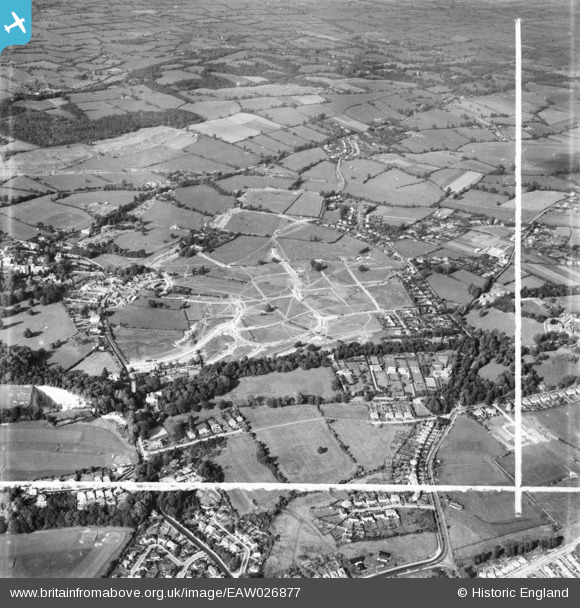
EAW026877 ENGLAND (1949). Henbury Housing Estate under construction, Henbury, 1949. This image was marked by Aerofilms Ltd for photo editing.
© Copyright OpenStreetMap contributors and licensed by the OpenStreetMap Foundation. 2026. Cartography is licensed as CC BY-SA.
Nearby Images (7)
EAW026877

EAW026872

EAW026876

EAW026871

EAW026873
, Henbury, 1949. This image has been produced from a damaged negative.")
EAW026874

EAW026875

Details
| Title | [EAW026877] Henbury Housing Estate under construction, Henbury, 1949. This image was marked by Aerofilms Ltd for photo editing. |
| Reference | EAW026877 |
| Date | 2-October-1949 |
| Link | |
| Place name | HENBURY |
| Parish | |
| District | |
| Country | ENGLAND |
| Easting / Northing | 356959, 178821 |
| Longitude / Latitude | -2.6202198501164, 51.506197223955 |
| National Grid Reference | ST570788 |
Pins

bristolian |
Thursday 8th of October 2020 07:50:43 PM | |
|
Buzzard |
Tuesday 27th of October 2015 09:40:22 AM | |
|
Buzzard |
Monday 6th of October 2014 06:50:13 PM | |
|
Buzzard |
Monday 6th of October 2014 06:49:36 PM | |
|
Buzzard |
Monday 6th of October 2014 06:49:07 PM | |
|
Buzzard |
Monday 6th of October 2014 06:48:31 PM | |
|
Buzzard |
Monday 6th of October 2014 06:47:52 PM | |
|
Buzzard |
Monday 6th of October 2014 06:46:53 PM | |
|
Buzzard |
Monday 6th of October 2014 06:46:19 PM | |
|
Buzzard |
Monday 6th of October 2014 06:45:45 PM | |
|
Buzzard |
Monday 6th of October 2014 06:44:19 PM | |
|
NicTomkins |
Tuesday 30th of September 2014 08:58:49 PM | |
|
NicTomkins |
Tuesday 30th of September 2014 08:54:45 PM | |

Class31 |
Monday 9th of June 2014 10:14:26 AM |
