
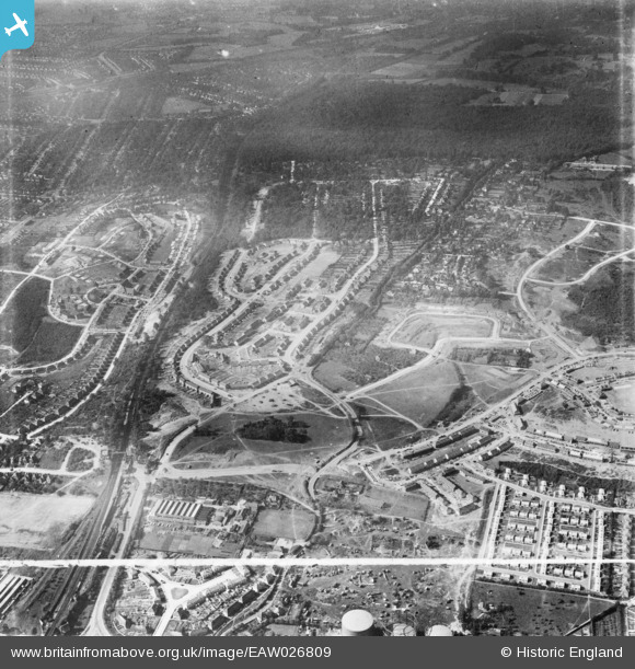
EAW026809 ENGLAND (1949). Housing estate under construction at St Paul's Cray, Bromley, 1949. This image was marked by Aerofilms Ltd for photo editing.
© Copyright OpenStreetMap contributors and licensed by the OpenStreetMap Foundation. 2026. Cartography is licensed as CC BY-SA.
Nearby Images (13)
EAW026809

EAW021760

EAW020740

EAW020733

EAW020738

EAW042064

EAW020739

EAW020730

EAW020741

EAW042062

EAW020742

EAW020737

EAW020719

Details
| Title | [EAW026809] Housing estate under construction at St Paul's Cray, Bromley, 1949. This image was marked by Aerofilms Ltd for photo editing. |
| Reference | EAW026809 |
| Date | 3-October-1949 |
| Link | |
| Place name | BROMLEY |
| Parish | |
| District | |
| Country | ENGLAND |
| Easting / Northing | 546212, 168547 |
| Longitude / Latitude | 0.10196765973188, 51.396595509599 |
| National Grid Reference | TQ462685 |
Pins

Post-war prefabs |
Saturday 2nd of November 2019 08:31:22 AM |