
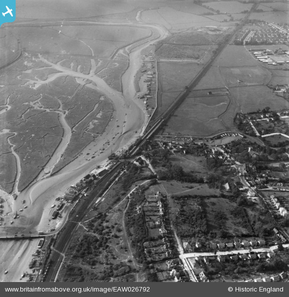
EAW026792 ENGLAND (1949). Benfleet Railway Station and environs, South Benfleet, 1949. This image has been produced from a print.
© Copyright OpenStreetMap contributors and licensed by the OpenStreetMap Foundation. 2026. Cartography is licensed as CC BY-SA.
Nearby Images (8)
EAW026792

EAW026787

EAW026789

EAW026791

EAW026788

EAW026790

EAW021063

EAW026793

Details
| Title | [EAW026792] Benfleet Railway Station and environs, South Benfleet, 1949. This image has been produced from a print. |
| Reference | EAW026792 |
| Date | 3-October-1949 |
| Link | |
| Place name | SOUTH BENFLEET |
| Parish | |
| District | |
| Country | ENGLAND |
| Easting / Northing | 577729, 185918 |
| Longitude / Latitude | 0.56335476796957, 51.54365177658 |
| National Grid Reference | TQ777859 |
Pins
Be the first to add a comment to this image!