
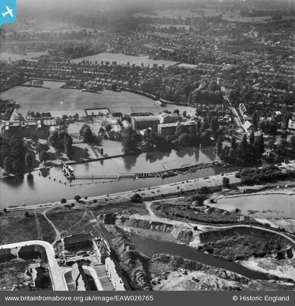
EAW026765 ENGLAND (1949). Teddington Weir under construction and the surrounding area, Teddington, 1949
© Copyright OpenStreetMap contributors and licensed by the OpenStreetMap Foundation. 2026. Cartography is licensed as CC BY-SA.
Nearby Images (37)
EAW026765

EAW007446

EAW026762

EAW026761

EAW026763

EAW026760

EAW026764

EPR000639

EPW023406

EPW023393

EAW008258

EAW007427

EPW023410

EPW023394

EAW007438

EAW007437

EAW007445

EAW007433

EAW007430

EAW007436

EAW007428

EAW007432

EAW007434

EAW042760

EAW007435

EAW007443

EAW008257

EAW007444

EAW008256

EAW007439

EPW050014

EAW007425

EAW007429

EAW042761

EAW007440

EAW007447

EPW023404

Details
| Title | [EAW026765] Teddington Weir under construction and the surrounding area, Teddington, 1949 |
| Reference | EAW026765 |
| Date | 3-October-1949 |
| Link | |
| Place name | TEDDINGTON |
| Parish | |
| District | |
| Country | ENGLAND |
| Easting / Northing | 516863, 171381 |
| Longitude / Latitude | -0.31880451372764, 51.428876427066 |
| National Grid Reference | TQ169714 |
Pins

colin t |
Tuesday 30th of June 2020 07:40:32 PM | |
|
J M H |
Saturday 30th of April 2016 10:01:34 PM | |
|
J M H |
Saturday 30th of April 2016 10:00:18 PM | |
|
J M H |
Saturday 30th of April 2016 09:59:31 PM | |
|
J M H |
Saturday 30th of April 2016 09:58:42 PM |