
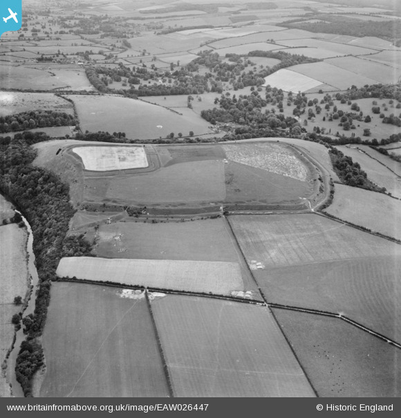
EAW026447 ENGLAND (1949). Hod Hill Camp and Lydsbury Rings, Hod Hill, 1949
© Copyright OpenStreetMap contributors and licensed by the OpenStreetMap Foundation. 2026. Cartography is licensed as CC BY-SA.
Nearby Images (3)
EAW026447

EAW026441

EAW026446

Details
| Title | [EAW026447] Hod Hill Camp and Lydsbury Rings, Hod Hill, 1949 |
| Reference | EAW026447 |
| Date | 8-September-1949 |
| Link | |
| Place name | HOD HILL |
| Parish | STOURPAINE |
| District | |
| Country | ENGLAND |
| Easting / Northing | 385595, 110463 |
| Longitude / Latitude | -2.2048369639632, 50.892915846976 |
| National Grid Reference | ST856105 |
