
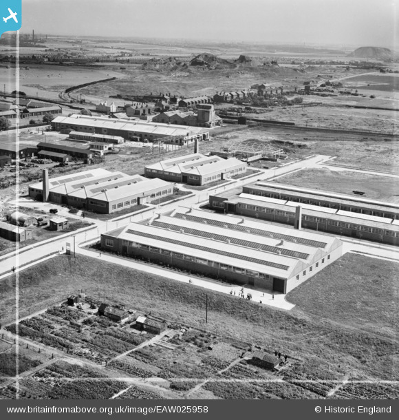
EAW025958 ENGLAND (1949). The Fothergill and Harvey Ltd Harvester Mill on the Parr Industrial Estate, St Helens, from the west, 1949. This image was marked by Aerofilms Ltd for photo editing.
© Copyright OpenStreetMap contributors and licensed by the OpenStreetMap Foundation. 2026. Cartography is licensed as CC BY-SA.
Nearby Images (8)
EAW025958

EAW025959

EAW025962

EAW025961

EAW025960

EAW025955

EAW025957

EAW025956

Details
| Title | [EAW025958] The Fothergill and Harvey Ltd Harvester Mill on the Parr Industrial Estate, St Helens, from the west, 1949. This image was marked by Aerofilms Ltd for photo editing. |
| Reference | EAW025958 |
| Date | 14-August-1949 |
| Link | |
| Place name | ST HELENS |
| Parish | |
| District | |
| Country | ENGLAND |
| Easting / Northing | 352884, 394816 |
| Longitude / Latitude | -2.7095018798467, 53.447743699898 |
| National Grid Reference | SJ529948 |
Pins

Jacksprat |
Sunday 10th of May 2020 11:13:03 AM | |
|
Jacksprat |
Tuesday 12th of November 2019 06:55:41 PM | |
|
Jacksprat |
Tuesday 12th of November 2019 06:54:50 PM | |
|
Jacksprat |
Tuesday 12th of November 2019 06:53:59 PM | |
|
Jacksprat |
Tuesday 12th of November 2019 06:52:10 PM | |
|
Jacksprat |
Tuesday 12th of November 2019 06:51:12 PM | |
|
Jacksprat |
Tuesday 12th of November 2019 06:47:56 PM | |
|
Gill Peet |
Thursday 2nd of January 2014 12:44:39 PM |
User Comment Contributions
In the background is the Red Rocks, formerly Ashton's Green Colliery, to the left , what would become Pennine Drive estate |
Gill Peet |
Thursday 2nd of January 2014 01:03:59 PM |