
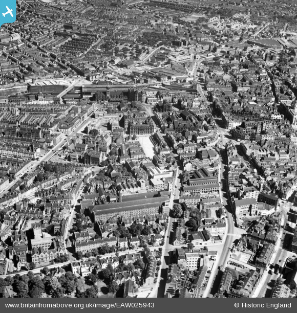
EAW025943 ENGLAND (1949). Burton Street and the city centre, Nottingham, 1949
© Copyright OpenStreetMap contributors and licensed by the OpenStreetMap Foundation. 2026. Cartography is licensed as CC BY-SA.
Nearby Images (7)
EAW025943

EAW021698

EPW054995

EPW054997

EPW013017

EPR000151

EPW047469

Details
| Title | [EAW025943] Burton Street and the city centre, Nottingham, 1949 |
| Reference | EAW025943 |
| Date | 15-August-1949 |
| Link | |
| Place name | NOTTINGHAM |
| Parish | |
| District | |
| Country | ENGLAND |
| Easting / Northing | 457066, 340215 |
| Longitude / Latitude | -1.1504433129791, 52.95595642474 |
| National Grid Reference | SK571402 |
Pins

KC |
Thursday 4th of September 2025 05:49:06 PM | |
|
KC |
Thursday 4th of September 2025 05:40:18 PM | |
|
KC |
Tuesday 18th of January 2022 08:09:52 PM | |
|
KC |
Tuesday 18th of January 2022 08:05:43 PM | |
|
NorthChurch |
Tuesday 16th of March 2021 12:38:35 PM | |
|
pf329 |
Friday 21st of June 2019 07:12:46 PM | |
|
DavidA |
Tuesday 21st of August 2018 12:38:25 PM | |
|
poohdog |
Friday 27th of June 2014 08:50:00 PM | |
|
poohdog |
Friday 27th of June 2014 08:49:03 PM |