
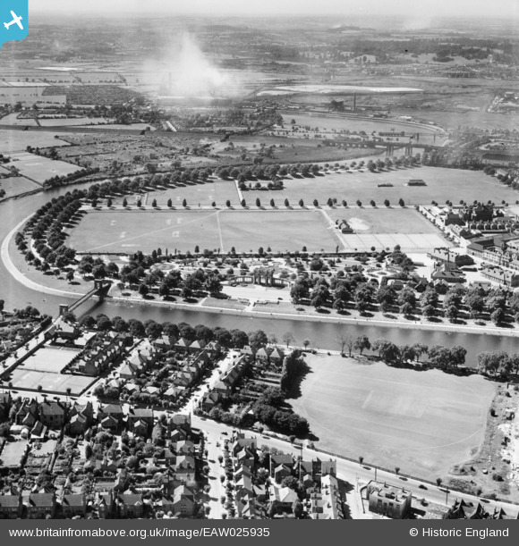
EAW025935 ENGLAND (1949). The Memorial Gardens and adjacent Recreation Ground, Meadows, 1949
© Copyright OpenStreetMap contributors and licensed by the OpenStreetMap Foundation. 2026. Cartography is licensed as CC BY-SA.
Nearby Images (11)
EAW025935

EPW021047

EPW019378

EPW019379

EPW021048

EPW021128

EPW021127

EPW021124

EPW021781

EPW057112

EPW038631

Details
| Title | [EAW025935] The Memorial Gardens and adjacent Recreation Ground, Meadows, 1949 |
| Reference | EAW025935 |
| Date | 15-August-1949 |
| Link | |
| Place name | MEADOWS |
| Parish | |
| District | |
| Country | ENGLAND |
| Easting / Northing | 457801, 337799 |
| Longitude / Latitude | -1.1399333698743, 52.934159604059 |
| National Grid Reference | SK578378 |
