
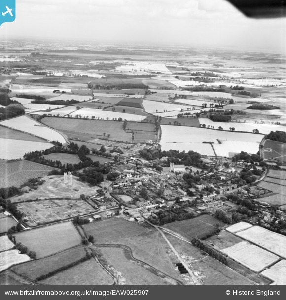
EAW025907 ENGLAND (1949). The town, Orford, from the south, 1949
© Copyright OpenStreetMap contributors and licensed by the OpenStreetMap Foundation. 2026. Cartography is licensed as CC BY-SA.
Nearby Images (10)
EAW025907

EAW025908

EAW037838

EAW037840

EAW038350

EAW037841

EAW037843

EAW037842

EAW038351

EAW037839

Details
| Title | [EAW025907] The town, Orford, from the south, 1949 |
| Reference | EAW025907 |
| Date | 10-August-1949 |
| Link | |
| Place name | ORFORD |
| Parish | ORFORD |
| District | |
| Country | ENGLAND |
| Easting / Northing | 642107, 249756 |
| Longitude / Latitude | 1.5348485766606, 52.092671682565 |
| National Grid Reference | TM421498 |
Pins

Matt Aldred edob.mattaldred.com |
Friday 20th of October 2023 01:24:39 PM | |

Chris Kolonko |
Saturday 16th of September 2017 07:31:51 PM |