
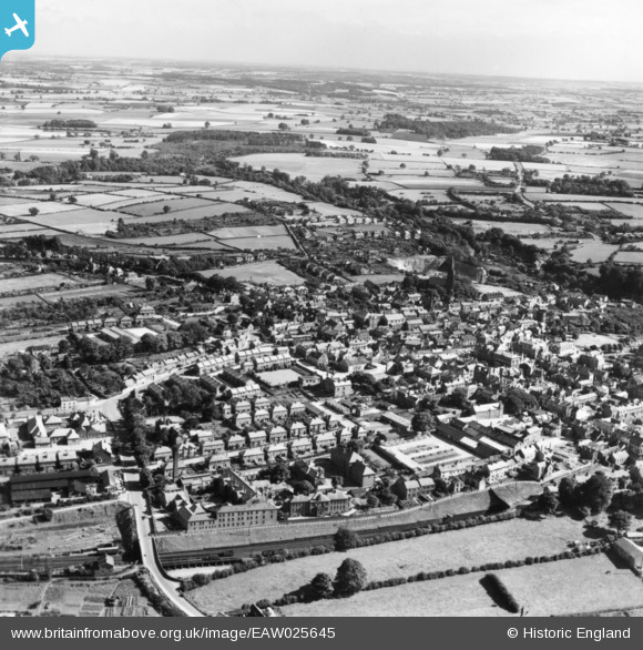
EAW025645 ENGLAND (1949). Knaresborough Hospital and part of the town, Knaresborough, from the north-west, 1949. This image has been produced from a print.
© Copyright OpenStreetMap contributors and licensed by the OpenStreetMap Foundation. 2026. Cartography is licensed as CC BY-SA.
Nearby Images (3)
EAW025645

EAW025646

EAW025643

Details
| Title | [EAW025645] Knaresborough Hospital and part of the town, Knaresborough, from the north-west, 1949. This image has been produced from a print. |
| Reference | EAW025645 |
| Date | 3-August-1949 |
| Link | |
| Place name | KNARESBOROUGH |
| Parish | KNARESBOROUGH |
| District | |
| Country | ENGLAND |
| Easting / Northing | 435095, 457212 |
| Longitude / Latitude | -1.4644268748251, 54.0095422632 |
| National Grid Reference | SE351572 |
Pins

MattG |
Sunday 4th of December 2016 10:39:21 PM | |
|
MattG |
Sunday 4th of December 2016 10:39:20 PM | |
|
John W |
Saturday 2nd of July 2016 05:52:40 PM | |
|
John W |
Saturday 2nd of July 2016 05:51:30 PM |