
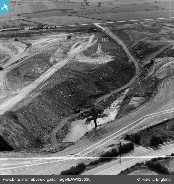
EAW025630 ENGLAND (1949). Billingley, Open Cast Coal Quarry south of the village, 1949. This image has been produced from a print.
© Copyright OpenStreetMap contributors and licensed by the OpenStreetMap Foundation. 2026. Cartography is licensed as CC BY-SA.
Nearby Images (15)
EAW025630

EAW025627

EAW025626

EAW025628

EAW025629

EAW025631

EAW025625

EAW025632

EAW025622

EAW025623

EAW025624

EAW025611

EAW015487

EAW025615

EAW015491

Details
| Title | [EAW025630] Billingley, Open Cast Coal Quarry south of the village, 1949. This image has been produced from a print. |
| Reference | EAW025630 |
| Date | 4-August-1949 |
| Link | |
| Place name | BILLINGLEY |
| Parish | BILLINGLEY |
| District | |
| Country | ENGLAND |
| Easting / Northing | 443366, 404063 |
| Longitude / Latitude | -1.3456856525504, 53.531185970815 |
| National Grid Reference | SE434041 |
Pins

Class31 |
Saturday 1st of November 2014 09:38:19 AM |