
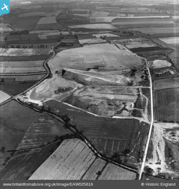
EAW025616 ENGLAND (1949). Billingley, Open Cast Coal Quarry south of the village, 1949. This image has been produced from a print.
© Copyright OpenStreetMap contributors and licensed by the OpenStreetMap Foundation. 2026. Cartography is licensed as CC BY-SA.
Nearby Images (7)
EAW025616

EAW025620

EAW025621

EAW025613

EAW025614

EAW025612

EAW046557

Details
| Title | [EAW025616] Billingley, Open Cast Coal Quarry south of the village, 1949. This image has been produced from a print. |
| Reference | EAW025616 |
| Date | 4-August-1949 |
| Link | |
| Place name | BILLINGLEY |
| Parish | |
| District | |
| Country | ENGLAND |
| Easting / Northing | 433444, 403940 |
| Longitude / Latitude | -1.4953964716075, 53.5308057266 |
| National Grid Reference | SE334039 |
Pins
User Comment Contributions
We are looking east. |

Class31 |
Saturday 1st of November 2014 09:21:16 AM |
This photo is of the A635 east of Darfield near Billingley. All the others will be of this area. |
Class31 |
Saturday 1st of November 2014 09:20:19 AM |
Eureka This is the big one! There are about 20 photos in this group. |
Class31 |
Saturday 1st of November 2014 09:19:02 AM |