
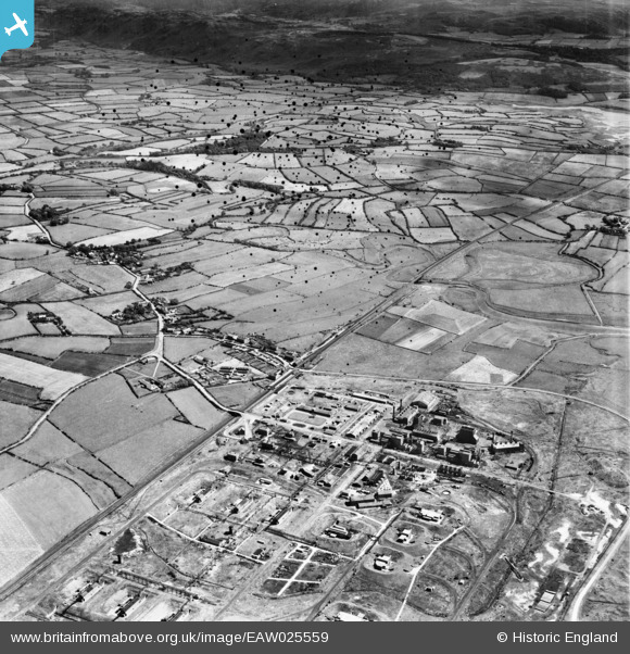
EAW025559 ENGLAND (1949). Royal Ordnance Factory (ROF) Drigg and environs, Drigg, from the west, 1949. This image has been produced from a damaged negative.
© Copyright OpenStreetMap contributors and licensed by the OpenStreetMap Foundation. 2026. Cartography is licensed as CC BY-SA.
Nearby Images (2)
EAW025559
 Drigg and environs, Drigg, from the west, 1949. This image has been produced from a damaged negative.")
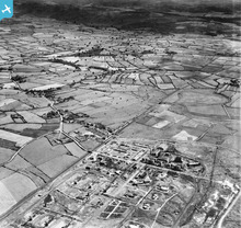
EAW025560
 Drigg and environs, Drigg, from the south-west, 1949")
Details
| Title | [EAW025559] Royal Ordnance Factory (ROF) Drigg and environs, Drigg, from the west, 1949. This image has been produced from a damaged negative. |
| Reference | EAW025559 |
| Date | 3-August-1949 |
| Link | |
| Place name | DRIGG |
| Parish | DRIGG AND CARLETON |
| District | |
| Country | ENGLAND |
| Easting / Northing | 306287, 498835 |
| Longitude / Latitude | -3.4428800228837, 54.376238091584 |
| National Grid Reference | SD063988 |
Pins

Matt Aldred edob.mattaldred.com |
Thursday 8th of May 2025 03:55:26 PM | |

redmist |
Sunday 7th of February 2021 10:37:05 PM | |
|
redmist |
Sunday 7th of February 2021 10:31:38 PM | |
|
redmist |
Sunday 7th of February 2021 10:30:22 PM | |
|
redmist |
Sunday 7th of February 2021 10:29:44 PM | |
|
redmist |
Sunday 7th of February 2021 10:29:15 PM | |
|
redmist |
Sunday 7th of February 2021 10:28:53 PM | |
|
cptpies |
Tuesday 4th of March 2014 12:48:07 PM | |
|
cptpies |
Tuesday 4th of March 2014 12:47:33 PM | |
|
cptpies |
Tuesday 4th of March 2014 12:47:04 PM | |
|
cptpies |
Tuesday 4th of March 2014 12:46:39 PM | |
|
cptpies |
Tuesday 4th of March 2014 12:46:13 PM | |
|
cptpies |
Tuesday 4th of March 2014 12:45:42 PM | |
|
cptpies |
Tuesday 4th of March 2014 12:44:57 PM | |
|
beast66606 |
Sunday 19th of January 2014 04:37:31 PM | |
|
MB |
Thursday 19th of December 2013 10:20:38 PM | |
|
MB |
Thursday 19th of December 2013 10:20:03 PM | |
|
MB |
Thursday 19th of December 2013 10:19:24 PM |
User Comment Contributions
ROF Pillboxes at ROF Drigg. |
cptpies |
Tuesday 4th of March 2014 12:48:46 PM |