
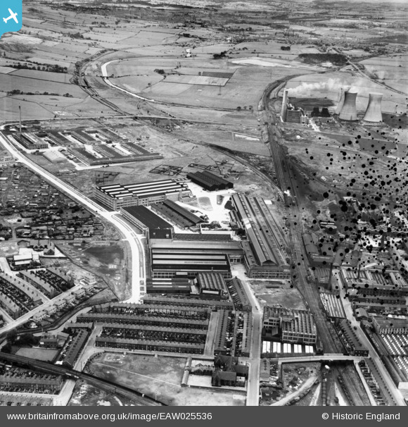
EAW025536 ENGLAND (1949). The Northrop Loom Works and Great Harwood Junction, Blackburn, 1949. This image has been produced from a damaged negative.
© Copyright OpenStreetMap contributors and licensed by the OpenStreetMap Foundation. 2026. Cartography is licensed as CC BY-SA.
Nearby Images (15)
EAW025536

EAW025535

EAW025540

EAW025527

EAW025539

EAW025538

EAW025537

EAW025532

EAW025534

EAW025528

EAW025533

EAW025526

EPW038982

EPW038980

EPW038981

Details
| Title | [EAW025536] The Northrop Loom Works and Great Harwood Junction, Blackburn, 1949. This image has been produced from a damaged negative. |
| Reference | EAW025536 |
| Date | 3-August-1949 |
| Link | |
| Place name | BLACKBURN |
| Parish | |
| District | |
| Country | ENGLAND |
| Easting / Northing | 369807, 429148 |
| Longitude / Latitude | -2.4580026745822, 53.757596306915 |
| National Grid Reference | SD698291 |
Pins

Matt Aldred edob.mattaldred.com |
Friday 8th of March 2024 05:36:53 PM |