
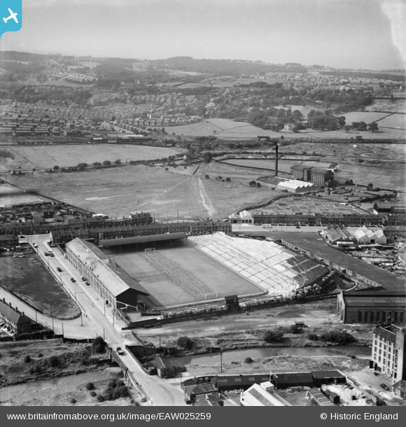
EAW025259 ENGLAND (1949). Leeds Road Football Ground (Huddersfield Town FC) and environs, Bradley Mills, from the south-east, 1949
© Copyright OpenStreetMap contributors and licensed by the OpenStreetMap Foundation. 2025. Cartography is licensed as CC BY-SA.
Nearby Images (3)
EAW025259
 and environs, Bradley Mills, from the south-east, 1949")
EAW025260
 and environs, Bradley Mills, from the north-west, 1949")
EPW045323

Details
| Title | [EAW025259] Leeds Road Football Ground (Huddersfield Town FC) and environs, Bradley Mills, from the south-east, 1949 |
| Reference | EAW025259 |
| Date | 25-July-1949 |
| Link | |
| Place name | BRADLEY MILLS |
| Parish | |
| District | |
| Country | ENGLAND |
| Easting / Northing | 415510, 417881 |
| Longitude / Latitude | -1.7652874873715, 53.656960441908 |
| National Grid Reference | SE155179 |
Pins
User Comment Contributions
Great old photo of Town ground. |

marmite |
Saturday 29th of March 2014 09:30:22 PM |