
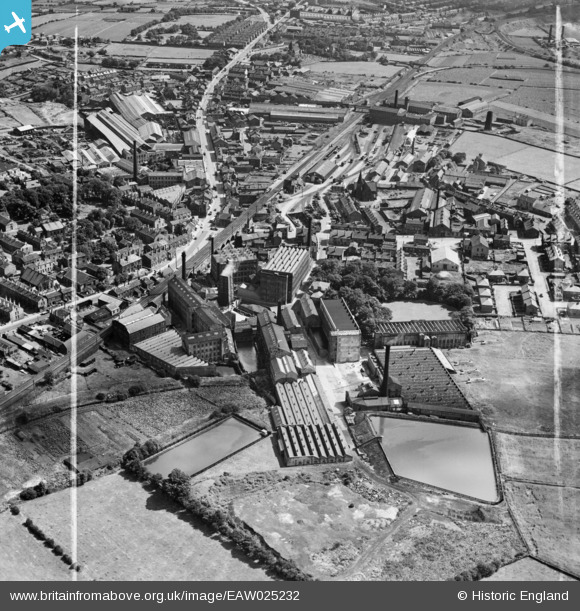
EAW025232 ENGLAND (1949). The Leigh Worsted Mills, Pudsey, 1949. This image was marked by Aerofilms Ltd for photo editing.
© Copyright OpenStreetMap contributors and licensed by the OpenStreetMap Foundation. 2026. Cartography is licensed as CC BY-SA.
Nearby Images (19)
EAW025232

EAW025238

EAW031363

EPW028887

EAW025235

EPW034273

EPW023834

EAW031362

EAW031369

EAW031368

EPW023836

EAW031364

EAW031367

EAW031365

EAW025233

EAW031366

EAW025234

EAW025236

EAW025231

Details
| Title | [EAW025232] The Leigh Worsted Mills, Pudsey, 1949. This image was marked by Aerofilms Ltd for photo editing. |
| Reference | EAW025232 |
| Date | 26-July-1949 |
| Link | |
| Place name | PUDSEY |
| Parish | |
| District | |
| Country | ENGLAND |
| Easting / Northing | 421928, 434243 |
| Longitude / Latitude | -1.6670053481463, 53.803808110087 |
| National Grid Reference | SE219342 |
Pins

Matt Aldred edob.mattaldred.com |
Friday 8th of March 2024 05:35:00 PM | |

Wozzy |
Thursday 21st of January 2021 04:38:26 PM | |

doc |
Tuesday 9th of July 2019 08:11:40 AM |