
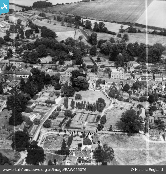
EAW025076 ENGLAND (1949). The Priory and environs, Redbourn, 1949. This image has been produced from a print marked by Aerofilms Ltd for photo editing.
© Copyright OpenStreetMap contributors and licensed by the OpenStreetMap Foundation. 2026. Cartography is licensed as CC BY-SA.
Nearby Images (5)
EAW025076

EAW025072

EAW025073

EAW025074

EAW025075

Details
| Title | [EAW025076] The Priory and environs, Redbourn, 1949. This image has been produced from a print marked by Aerofilms Ltd for photo editing. |
| Reference | EAW025076 |
| Date | 22-July-1949 |
| Link | |
| Place name | REDBOURN |
| Parish | REDBOURN |
| District | |
| Country | ENGLAND |
| Easting / Northing | 510774, 212216 |
| Longitude / Latitude | -0.3934540804928, 51.797158294202 |
| National Grid Reference | TL108122 |
Pins
Be the first to add a comment to this image!