
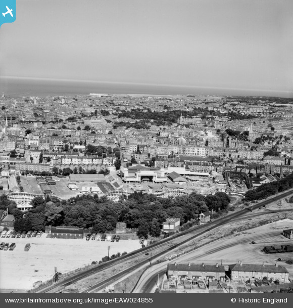
EAW024855 ENGLAND (1949). The town, Margate, from the south-west, 1949
© Copyright OpenStreetMap contributors and licensed by the OpenStreetMap Foundation. 2026. Cartography is licensed as CC BY-SA.
Nearby Images (15)
EAW024855

EPW035465

EPW035469

EPW009164

EPW009161

EPW042848

EAW024856

EPW009162

EPW035473

EPW039327

EPW039326

EPW052900

EPW009165

EPW018605

EPW000630

Details
| Title | [EAW024855] The town, Margate, from the south-west, 1949 |
| Reference | EAW024855 |
| Date | 12-July-1949 |
| Link | |
| Place name | MARGATE |
| Parish | |
| District | |
| Country | ENGLAND |
| Easting / Northing | 634921, 170540 |
| Longitude / Latitude | 1.3766514847422, 51.38470468135 |
| National Grid Reference | TR349705 |
Pins
Be the first to add a comment to this image!