
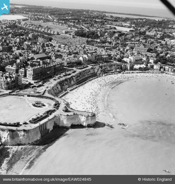
EAW024845 ENGLAND (1949). Viking Bay, Broadstairs, 1949
© Copyright OpenStreetMap contributors and licensed by the OpenStreetMap Foundation. 2026. Cartography is licensed as CC BY-SA.
Nearby Images (27)
EAW024845

EPW009185

EAW024846

EAW015846

EPW035459

EPW035455

EPW000344

EAW015847

EPW052894

EPW035456

EPW009184

EPW000611

EPW042844

EAW015844

EAW015845

EPW035457

EPW000607

EPW035454

EPW000118

EPW000606

EPW000609

EPW000608

EPW042846

EAW024847

EAW024848

EPW000610

EPW000119

Details
| Title | [EAW024845] Viking Bay, Broadstairs, 1949 |
| Reference | EAW024845 |
| Date | 12-July-1949 |
| Link | |
| Place name | BROADSTAIRS |
| Parish | BROADSTAIRS AND ST. PETERS |
| District | |
| Country | ENGLAND |
| Easting / Northing | 639789, 167692 |
| Longitude / Latitude | 1.4445663409327, 51.357104358136 |
| National Grid Reference | TR398677 |
Pins

Dodger |
Friday 27th of February 2015 12:03:33 PM |