
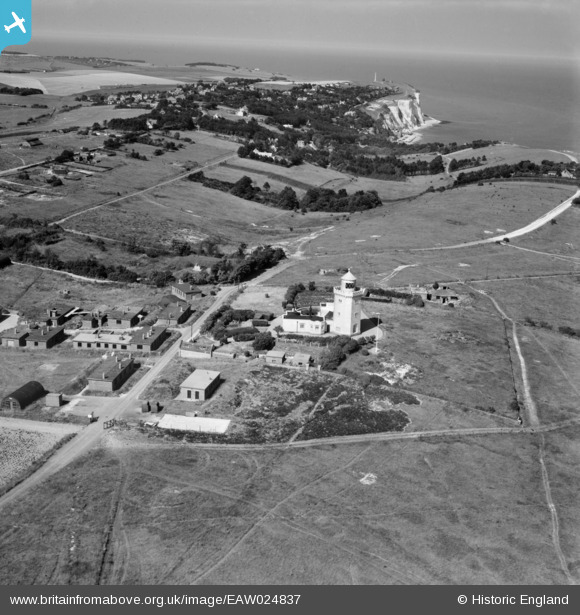
EAW024837 ENGLAND (1949). The South Foreland Lighthouse, South Foreland, 1949
© Copyright OpenStreetMap contributors and licensed by the OpenStreetMap Foundation. 2026. Cartography is licensed as CC BY-SA.
Nearby Images (7)
EAW024837

EAW024838

EAW024839

EPW017122

EAW024836

EAW020460

EAW020461

Details
| Title | [EAW024837] The South Foreland Lighthouse, South Foreland, 1949 |
| Reference | EAW024837 |
| Date | 12-July-1949 |
| Link | |
| Place name | SOUTH FORELAND |
| Parish | ST. MARGARET'S AT CLIFFE |
| District | |
| Country | ENGLAND |
| Easting / Northing | 635923, 143353 |
| Longitude / Latitude | 1.3730948439035, 51.140226134702 |
| National Grid Reference | TR359434 |
Pins
Slappyhead |
Tuesday 24th of October 2017 09:54:13 PM | |
|
Slappyhead |
Tuesday 24th of October 2017 09:53:31 PM | |
|
Slappyhead |
Tuesday 24th of October 2017 09:52:53 PM | |
|
Slappyhead |
Tuesday 24th of October 2017 09:52:17 PM | |

The Laird |
Saturday 9th of May 2015 01:14:28 PM | |
|
The Laird |
Saturday 9th of May 2015 11:45:47 AM |