
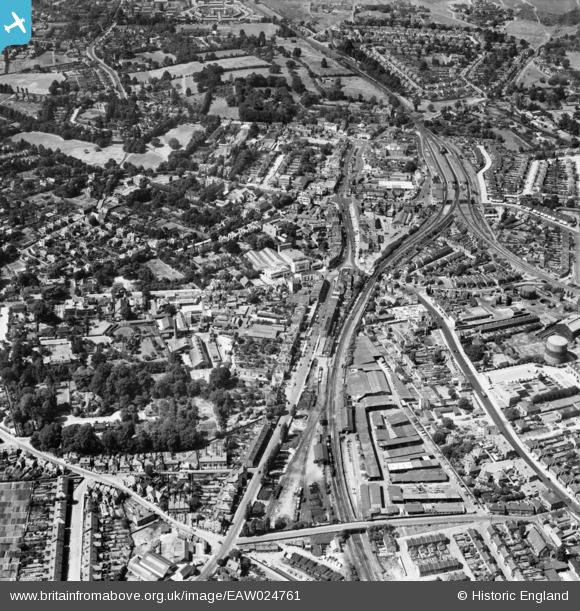
EAW024761 ENGLAND (1949). The town centre, Epsom, 1949
© Copyright OpenStreetMap contributors and licensed by the OpenStreetMap Foundation. 2026. Cartography is licensed as CC BY-SA.
Nearby Images (8)
EAW024761

EPW008683

EPW025153

EPW048878

EPW048879

EPW006486

EPW006487

EPW007916

Details
| Title | [EAW024761] The town centre, Epsom, 1949 |
| Reference | EAW024761 |
| Date | 12-July-1949 |
| Link | |
| Place name | EPSOM |
| Parish | |
| District | |
| Country | ENGLAND |
| Easting / Northing | 521175, 160834 |
| Longitude / Latitude | -0.2604008035813, 51.333168542761 |
| National Grid Reference | TQ212608 |
Pins

Matt Aldred edob.mattaldred.com |
Friday 27th of September 2024 04:41:35 PM | |

Good Old Uncle Ted |
Wednesday 10th of July 2024 06:02:44 PM | |
|
Good Old Uncle Ted |
Wednesday 10th of July 2024 06:00:44 PM | |
|
Matt Aldred edob.mattaldred.com |
Sunday 18th of July 2021 01:53:27 PM | |

Class31 |
Tuesday 21st of June 2016 07:50:11 AM | |
|
Class31 |
Tuesday 21st of June 2016 07:48:44 AM |


