
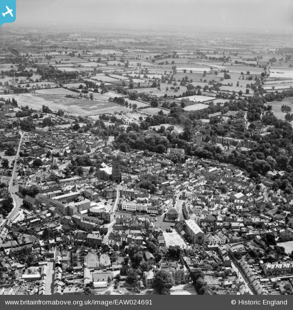
EAW024691 ENGLAND (1949). St Mary's Church, Warwick Castle and the town centre, Warwick, from the north-west, 1949
© Copyright OpenStreetMap contributors and licensed by the OpenStreetMap Foundation. 2026. Cartography is licensed as CC BY-SA.
Nearby Images (19)
EAW024691

EAW003265

EPW019742

EPW053229

EPW000410

EPW035695

EAW024695

EPW000407

EPW000412

EAW042926

EAW024692

EAW042928

EAW003264

EAW042927

EPW001213

EPW019741

EPW000403

EAW003655

EPW000409

Details
| Title | [EAW024691] St Mary's Church, Warwick Castle and the town centre, Warwick, from the north-west, 1949 |
| Reference | EAW024691 |
| Date | 12-July-1949 |
| Link | |
| Place name | WARWICK |
| Parish | WARWICK |
| District | |
| Country | ENGLAND |
| Easting / Northing | 428037, 264959 |
| Longitude / Latitude | -1.5889734660339, 52.281665981482 |
| National Grid Reference | SP280650 |
Pins
Be the first to add a comment to this image!