
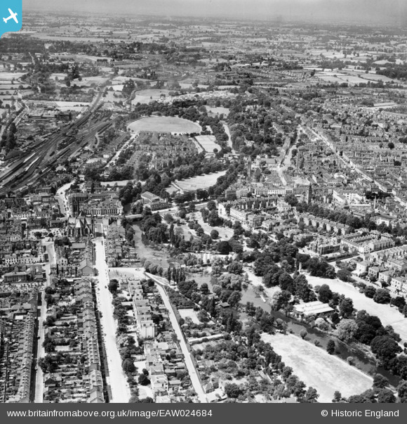
EAW024684 ENGLAND (1949). The Spa Gardens and the town centre, Royal Leamington Spa, from the east, 1949
© Copyright OpenStreetMap contributors and licensed by the OpenStreetMap Foundation. 2026. Cartography is licensed as CC BY-SA.
Nearby Images (9)
EAW024684

EPW039092

EPW053219

EPW053226

EPW001215

EAW024689

EAW003636

EPW005099

EPW005100

Details
| Title | [EAW024684] The Spa Gardens and the town centre, Royal Leamington Spa, from the east, 1949 |
| Reference | EAW024684 |
| Date | 12-July-1949 |
| Link | |
| Place name | ROYAL LEAMINGTON SPA |
| Parish | ROYAL LEAMINGTON SPA |
| District | |
| Country | ENGLAND |
| Easting / Northing | 432225, 265584 |
| Longitude / Latitude | -1.527519118327, 52.287055718086 |
| National Grid Reference | SP322656 |
Pins

clippedwings |
Thursday 26th of February 2015 03:29:02 PM | |
|
clippedwings |
Thursday 26th of February 2015 03:21:02 PM |