
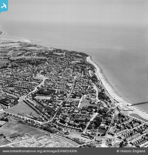
EAW024306 ENGLAND (1949). The town, Felixstowe, from the south-west, 1949
© Copyright OpenStreetMap contributors and licensed by the OpenStreetMap Foundation. 2026. Cartography is licensed as CC BY-SA.
Nearby Images (7)
EAW024306

EAW024305

EPW001918

EPW001921

EPW001919

EPW039279

EAW024310

Details
| Title | [EAW024306] The town, Felixstowe, from the south-west, 1949 |
| Reference | EAW024306 |
| Date | 4-July-1949 |
| Link | |
| Place name | FELIXSTOWE |
| Parish | FELIXSTOWE |
| District | |
| Country | ENGLAND |
| Easting / Northing | 629812, 234293 |
| Longitude / Latitude | 1.3452942216736, 51.95911299633 |
| National Grid Reference | TM298343 |
Pins

redmist |
Wednesday 10th of December 2025 08:29:24 PM | |

Matt Aldred edob.mattaldred.com |
Tuesday 9th of March 2021 01:36:26 PM | |
|
cptpies |
Tuesday 14th of January 2014 09:52:28 AM |
User Comment Contributions

Type 23 Pillbox. |
cptpies |
Tuesday 14th of January 2014 09:53:52 AM |