
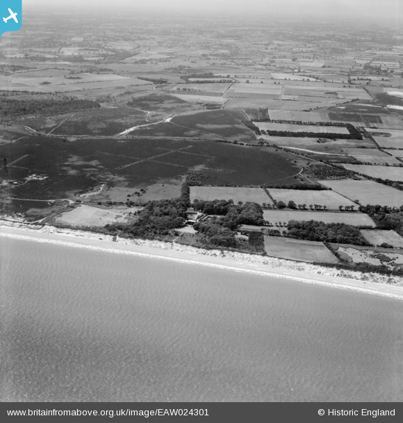
EAW024301 ENGLAND (1949). Anti-glider trenches on Dunwich Common, Dunwich, from the north-east, 1949
© Copyright OpenStreetMap contributors and licensed by the OpenStreetMap Foundation. 2026. Cartography is licensed as CC BY-SA.
Details
| Title | [EAW024301] Anti-glider trenches on Dunwich Common, Dunwich, from the north-east, 1949 |
| Reference | EAW024301 |
| Date | 4-July-1949 |
| Link | |
| Place name | DUNWICH |
| Parish | DUNWICH |
| District | |
| Country | ENGLAND |
| Easting / Northing | 647861, 268882 |
| Longitude / Latitude | 1.6326524258991, 52.261751412037 |
| National Grid Reference | TM479689 |
Pins

Matt Aldred edob.mattaldred.com |
Tuesday 1st of December 2020 07:46:36 PM | |
|
Matt Aldred edob.mattaldred.com |
Tuesday 1st of December 2020 07:46:22 PM | |
|
Matt Aldred edob.mattaldred.com |
Tuesday 1st of December 2020 07:46:12 PM | |
|
Matt Aldred edob.mattaldred.com |
Tuesday 1st of December 2020 07:45:49 PM | |
|
Matt Aldred edob.mattaldred.com |
Tuesday 1st of December 2020 07:45:32 PM | |
|
Matt Aldred edob.mattaldred.com |
Tuesday 1st of December 2020 07:45:11 PM | |
|
Matt Aldred edob.mattaldred.com |
Tuesday 1st of December 2020 07:44:40 PM | |

Mark P |
Friday 3rd of July 2020 11:13:19 PM | |
|
Al |
Sunday 8th of March 2015 08:31:12 PM | |
|
Graham Yaxley |
Saturday 17th of January 2015 05:55:58 PM | |
Dunwich CHL Tower presumably |

JMB |
Tuesday 21st of April 2015 12:48:10 PM |
|
Graham Yaxley |
Saturday 17th of January 2015 05:54:54 PM | |
recorded on the eDoB database as e21488 |
Al |
Sunday 8th of March 2015 08:30:42 PM |
