
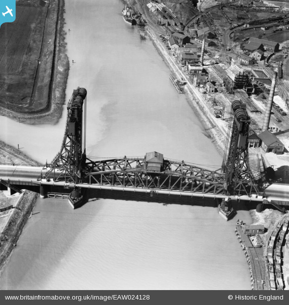
EAW024128 ENGLAND (1949). The Tees (Newport) Bridge, Middlesbrough, 1949
© Copyright OpenStreetMap contributors and licensed by the OpenStreetMap Foundation. 2026. Cartography is licensed as CC BY-SA.
Nearby Images (6)
EAW024128
 Bridge, Middlesbrough, 1949")
EPW042126

EAW024130
 Bridge, Middlesbrough, 1949")
EAW024129
 Bridge, Middlesbrough, 1949")
EAW013849

EPW042125

Details
| Title | [EAW024128] The Tees (Newport) Bridge, Middlesbrough, 1949 |
| Reference | EAW024128 |
| Date | 22-June-1949 |
| Link | |
| Place name | MIDDLESBROUGH |
| Parish | |
| District | |
| Country | ENGLAND |
| Easting / Northing | 447864, 519926 |
| Longitude / Latitude | -1.259536076845, 54.572160534186 |
| National Grid Reference | NZ479199 |
Pins

redmist |
Monday 29th of November 2021 07:51:59 PM | |
|
redmist |
Monday 29th of November 2021 07:45:37 PM | |
|
Stubzi34 |
Thursday 19th of June 2014 07:39:15 PM | |
|
MB |
Wednesday 25th of December 2013 11:12:54 AM |