
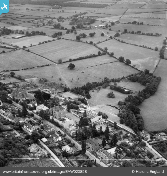
EAW023858 ENGLAND (1949). The Abbey on Wells Road and environs, Malvern Wells, 1949. This image was marked by Aerofilms Ltd for photo editing.
© Copyright OpenStreetMap contributors and licensed by the OpenStreetMap Foundation. 2025. Cartography is licensed as CC BY-SA.
Nearby Images (4)
EAW023858

EAW023859

EAW023857

EAW023860

Details
| Title | [EAW023858] The Abbey on Wells Road and environs, Malvern Wells, 1949. This image was marked by Aerofilms Ltd for photo editing. |
| Reference | EAW023858 |
| Date | 15-June-1949 |
| Link | |
| Place name | MALVERN WELLS |
| Parish | MALVERN WELLS |
| District | |
| Country | ENGLAND |
| Easting / Northing | 377466, 241689 |
| Longitude / Latitude | -2.3288069463978, 52.072691174346 |
| National Grid Reference | SO775417 |
