
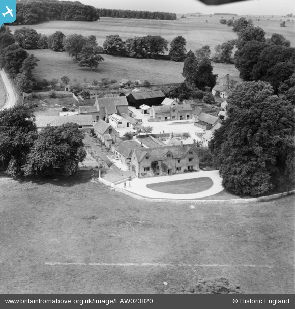
EAW023820 ENGLAND (1949). Upper Swell Farm, Upper Swell, 1949. This image was marked by Aerofilms Ltd for photo editing.
© Copyright OpenStreetMap contributors and licensed by the OpenStreetMap Foundation. 2026. Cartography is licensed as CC BY-SA.
Nearby Images (4)
EAW023820

EAW023821

EAW023819

EAW023822

Details
| Title | [EAW023820] Upper Swell Farm, Upper Swell, 1949. This image was marked by Aerofilms Ltd for photo editing. |
| Reference | EAW023820 |
| Date | 15-June-1949 |
| Link | |
| Place name | UPPER SWELL |
| Parish | SWELL |
| District | |
| Country | ENGLAND |
| Easting / Northing | 417673, 226748 |
| Longitude / Latitude | -1.7428928738603, 51.938523581542 |
| National Grid Reference | SP177267 |
Pins
Be the first to add a comment to this image!