
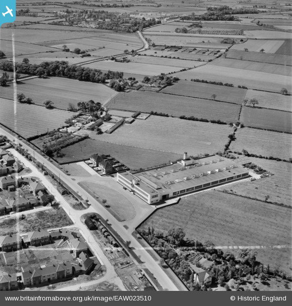
EAW023510 ENGLAND (1949). The Daylight Bakery, Stockton-on-Tees, 1949. This image was marked by Aerofilms Ltd for photo editing.
© Copyright OpenStreetMap contributors and licensed by the OpenStreetMap Foundation. 2026. Cartography is licensed as CC BY-SA.
Nearby Images (24)
EAW023510

EAW016858

EAW020583

EAW016861

EAW020578

EAW020573

EAW016860

EAW016857

EAW023505

EAW020571

EAW023511

EAW020572

EAW020577

EAW023506

EAW016856

EAW016859

EAW020579

EAW020574

EAW020570

EAW023508

EAW016863

EAW023514

EAW020575

EAW020576

Details
| Title | [EAW023510] The Daylight Bakery, Stockton-on-Tees, 1949. This image was marked by Aerofilms Ltd for photo editing. |
| Reference | EAW023510 |
| Date | 28-May-1949 |
| Link | |
| Place name | STOCKTON-ON-TEES |
| Parish | |
| District | |
| Country | ENGLAND |
| Easting / Northing | 442879, 520110 |
| Longitude / Latitude | -1.3366219191581, 54.574261432254 |
| National Grid Reference | NZ429201 |
Pins

J May |
Friday 10th of February 2017 01:37:25 PM |