
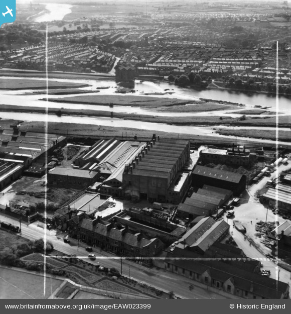
EAW023399 ENGLAND (1949). The Lancaster Straw Mill, the River Lune and environs, Lancaster, 1949. This image has been produced from a print marked by Aerofilms Ltd for photo editing.
© Copyright OpenStreetMap contributors and licensed by the OpenStreetMap Foundation. 2026. Cartography is licensed as CC BY-SA.
Nearby Images (9)
EAW023399

EAW023407

EAW023402

EAW023403

EAW023401

EAW023400

EAW023404

EAW023405

EAW023406

Details
| Title | [EAW023399] The Lancaster Straw Mill, the River Lune and environs, Lancaster, 1949. This image has been produced from a print marked by Aerofilms Ltd for photo editing. |
| Reference | EAW023399 |
| Date | 25-May-1949 |
| Link | |
| Place name | LANCASTER |
| Parish | |
| District | |
| Country | ENGLAND |
| Easting / Northing | 348388, 463215 |
| Longitude / Latitude | -2.7886319957623, 54.062109009612 |
| National Grid Reference | SD484632 |
