
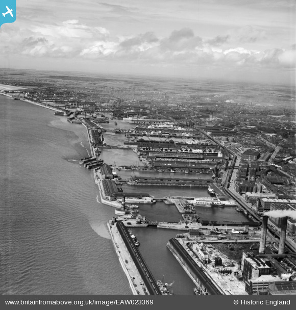
EAW023369 ENGLAND (1949). The Docks, Liverpool, from the south, 1949
© Copyright OpenStreetMap contributors and licensed by the OpenStreetMap Foundation. 2026. Cartography is licensed as CC BY-SA.
Nearby Images (5)
EAW023369

EAW050252

EAW001702

EPW051516

EAW038526

Details
| Title | [EAW023369] The Docks, Liverpool, from the south, 1949 |
| Reference | EAW023369 |
| Date | 24-May-1949 |
| Link | |
| Place name | LIVERPOOL |
| Parish | |
| District | |
| Country | ENGLAND |
| Easting / Northing | 333372, 392182 |
| Longitude / Latitude | -3.0027259827559, 53.421962847007 |
| National Grid Reference | SJ334922 |
Pins

austin |
Thursday 27th of July 2023 01:15:50 PM | |
|
austin |
Thursday 27th of July 2023 01:10:37 PM | |
|
redmist |
Saturday 13th of February 2021 06:45:19 PM | |
|
redmist |
Saturday 13th of February 2021 06:40:04 PM | |
|
redmist |
Saturday 13th of February 2021 06:38:38 PM | |
|
redmist |
Saturday 13th of February 2021 06:37:29 PM |