
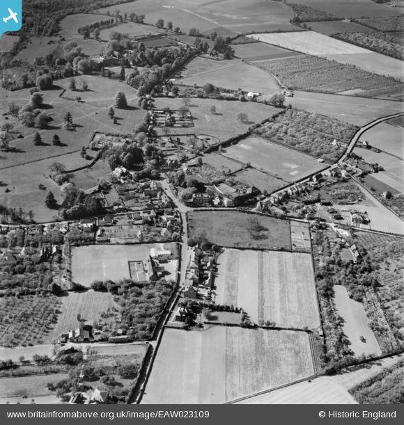
EAW023109 ENGLAND (1949). The village, Halstead, 1949
© Copyright OpenStreetMap contributors and licensed by the OpenStreetMap Foundation. 2026. Cartography is licensed as CC BY-SA.
Nearby Images (2)
EAW023109

EAW023108

Details
| Title | [EAW023109] The village, Halstead, 1949 |
| Reference | EAW023109 |
| Date | 10-May-1949 |
| Link | |
| Place name | HALSTEAD |
| Parish | HALSTEAD |
| District | |
| Country | ENGLAND |
| Easting / Northing | 548835, 161180 |
| Longitude / Latitude | 0.13656433978498, 51.329710169078 |
| National Grid Reference | TQ488612 |
Pins

Dicko99 |
Tuesday 30th of April 2019 02:08:53 PM | |
|
Dicko99 |
Tuesday 30th of April 2019 02:08:03 PM | |

Sparky |
Monday 28th of August 2017 11:33:57 AM | |
|
Sparky |
Monday 28th of August 2017 11:32:46 AM | |
|
Lynn Mann |
Thursday 3rd of September 2015 11:09:50 PM | |
|
Lynn Mann |
Thursday 3rd of September 2015 07:21:02 PM | |
|
Lynn Mann |
Thursday 3rd of September 2015 07:20:35 PM | |
|
Lynn Mann |
Thursday 3rd of September 2015 07:10:28 PM | |
|
Lynn Mann |
Thursday 3rd of September 2015 07:07:44 PM |