
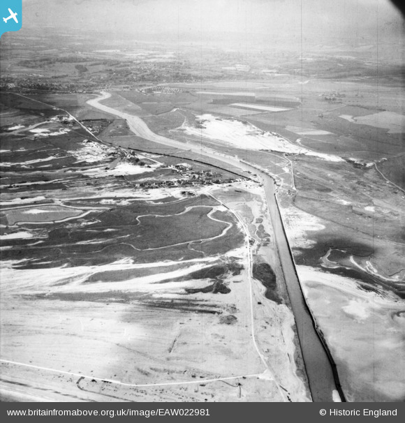
EAW022981 ENGLAND (1949). The River Rother, village and Northpoint Beach, Rye Harbour, from the south-east, 1949
© Copyright OpenStreetMap contributors and licensed by the OpenStreetMap Foundation. 2026. Cartography is licensed as CC BY-SA.
Nearby Images (2)
EAW022981

EPW026250

Details
| Title | [EAW022981] The River Rother, village and Northpoint Beach, Rye Harbour, from the south-east, 1949 |
| Reference | EAW022981 |
| Date | 6-May-1949 |
| Link | |
| Place name | RYE HARBOUR |
| Parish | ICKLESHAM |
| District | |
| Country | ENGLAND |
| Easting / Northing | 594670, 118252 |
| Longitude / Latitude | 0.77061509639517, 50.930269636713 |
| National Grid Reference | TQ947183 |
Pins
User Comment Contributions

MG Emplacements, Rye. |

cptpies |
Thursday 9th of April 2015 01:41:36 PM |