
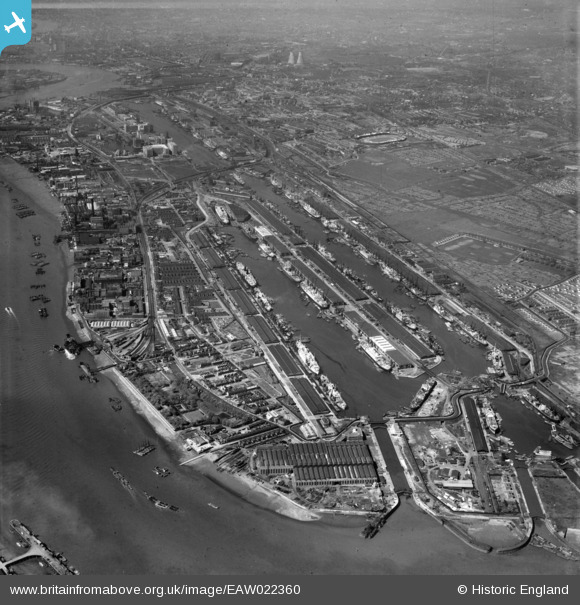
EAW022360 ENGLAND (1949). The Royal Docks and environs, North Woolwich, from the east, 1949
© Copyright OpenStreetMap contributors and licensed by the OpenStreetMap Foundation. 2026. Cartography is licensed as CC BY-SA.
Nearby Images (10)
EAW022360

EAW008740

EAW014133

EAW000055

EPW044126

EAW022358

EPW008885

EPW008553

EAW000051

EAW049351

Details
| Title | [EAW022360] The Royal Docks and environs, North Woolwich, from the east, 1949 |
| Reference | EAW022360 |
| Date | 19-April-1949 |
| Link | |
| Place name | NORTH WOOLWICH |
| Parish | |
| District | |
| Country | ENGLAND |
| Easting / Northing | 543575, 180150 |
| Longitude / Latitude | 0.068793485159772, 51.501542140565 |
| National Grid Reference | TQ436802 |
Pins

Nowy Paul |
Sunday 18th of November 2018 03:13:06 PM |