
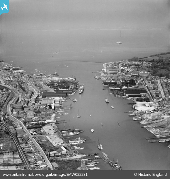
EAW022231 ENGLAND (1949). Cowes Harbour, East Cowes and the town, Cowes, from the south, 1949
© Copyright OpenStreetMap contributors and licensed by the OpenStreetMap Foundation. 2026. Cartography is licensed as CC BY-SA.
Nearby Images (12)
EAW022231

EPW023052

EAW025032

EAW015265

EAW022230

EPW022951

EPW039662

EAW025029

EAW025030

EAW025031

EAW025035

EAW022229

Details
| Title | [EAW022231] Cowes Harbour, East Cowes and the town, Cowes, from the south, 1949 |
| Reference | EAW022231 |
| Date | 17-April-1949 |
| Link | |
| Place name | COWES |
| Parish | COWES |
| District | |
| Country | ENGLAND |
| Easting / Northing | 449946, 95018 |
| Longitude / Latitude | -1.2919059173821, 50.752040571224 |
| National Grid Reference | SZ499950 |
