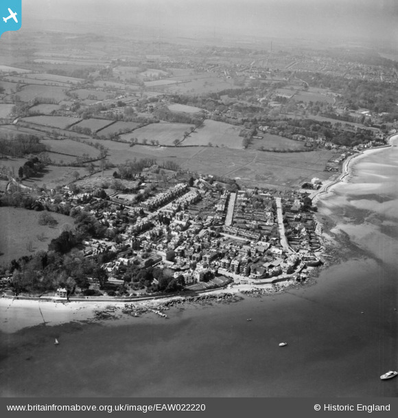
EAW022220 ENGLAND (1949). Nettlestone Point and the village, Seaview, from the east, 1949
    © Copyright OpenStreetMap contributors and licensed by the OpenStreetMap Foundation. 2025. Cartography is licensed as CC BY-SA.
  
Nearby Images (6)
Details
| Title | [EAW022220] Nettlestone Point and the village, Seaview, from the east, 1949 | 
| Reference | EAW022220 | 
| Date | 17-May-1949 | 
| Link | |
| Place name | SEAVIEW | 
| Parish | NETTLESTONE AND SEAVIEW | 
| District | |
| Country | ENGLAND | 
| Easting / Northing | 463013, 91580 | 
| Longitude / Latitude | -1.1072620189432, 50.71985223326 | 
| National Grid Reference | SZ630916 | 
Pins
Be the first to add a comment to this image!
 
             
  ![[EAW022220] Nettlestone Point and the village, Seaview, from the east, 1949](http://britainfromabove.org.uk/sites/all/libraries/aerofilms-images/public/100x100/EAW/022/EAW022220.jpg) 
  
                                          ![[EPW039636] Nettlestone Point and environs, Seaview, 1932](http://britainfromabove.org.uk/sites/all/libraries/aerofilms-images/public/100x100/EPW/039/EPW039636.jpg) 
 ![[EPW000790] The High Street, Seaview, from the north-east, 1920](http://britainfromabove.org.uk/sites/all/libraries/aerofilms-images/public/100x100/EPW/000/EPW000790.jpg) 
 ![[EPW043021] Nettlestone Point and the coast towards Ryde, Seaview, from the east, 1933](http://britainfromabove.org.uk/sites/all/libraries/aerofilms-images/public/100x100/EPW/043/EPW043021.jpg) 
 ![[EPW023042] Nettlestone Point and the village, Seaview, 1928. This image has been produced from a copy-negative.](http://britainfromabove.org.uk/sites/all/libraries/aerofilms-images/public/100x100/EPW/023/EPW023042.jpg) 
 ![[EPW023039] Seafield Road and environs, Seaview, 1928](http://britainfromabove.org.uk/sites/all/libraries/aerofilms-images/public/100x100/EPW/023/EPW023039.jpg)