
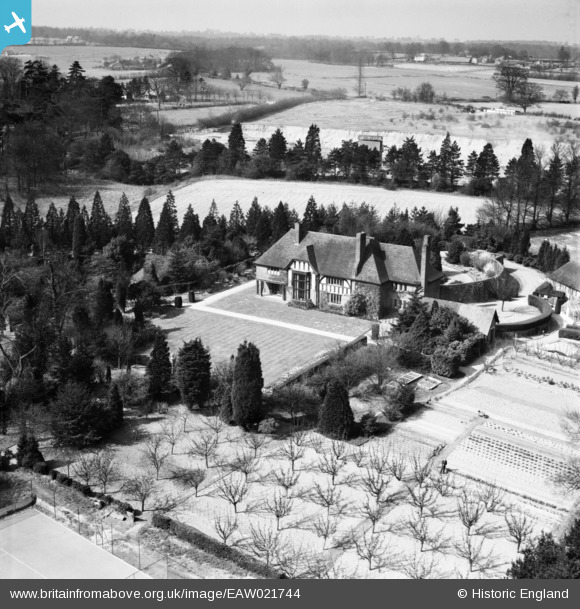
EAW021744 ENGLAND (1949). Falcon Hall, Wormley, from the south-east, 1949
© Copyright OpenStreetMap contributors and licensed by the OpenStreetMap Foundation. 2026. Cartography is licensed as CC BY-SA.
Nearby Images (4)
EAW021744

EAW021746

EAW021745

EAW021743

Details
| Title | [EAW021744] Falcon Hall, Wormley, from the south-east, 1949 |
| Reference | EAW021744 |
| Date | 1-April-1949 |
| Link | |
| Place name | WORMLEY |
| Parish | |
| District | |
| Country | ENGLAND |
| Easting / Northing | 535525, 206031 |
| Longitude / Latitude | -0.037112400589567, 51.736124384277 |
| National Grid Reference | TL355060 |
Pins
Be the first to add a comment to this image!