
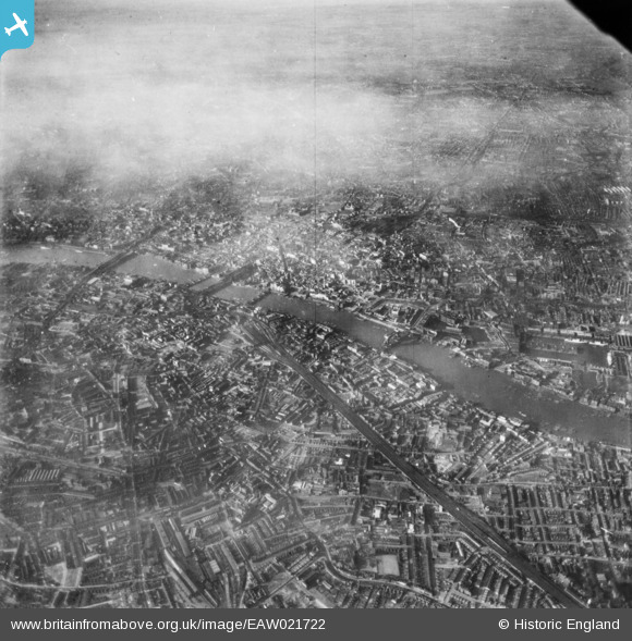
EAW021722 ENGLAND (1949). A cityscape over central London, Bermondsey, from the south-east, 1949. This image has been produced from a print.
© Copyright OpenStreetMap contributors and licensed by the OpenStreetMap Foundation. 2026. Cartography is licensed as CC BY-SA.
Nearby Images (3)
EAW021722

EPW010948

EAW041820

Details
| Title | [EAW021722] A cityscape over central London, Bermondsey, from the south-east, 1949. This image has been produced from a print. |
| Reference | EAW021722 |
| Date | 26-March-1949 |
| Link | |
| Place name | BERMONDSEY |
| Parish | |
| District | |
| Country | ENGLAND |
| Easting / Northing | 533576, 179526 |
| Longitude / Latitude | -0.075429194952921, 51.498385999467 |
| National Grid Reference | TQ336795 |
