
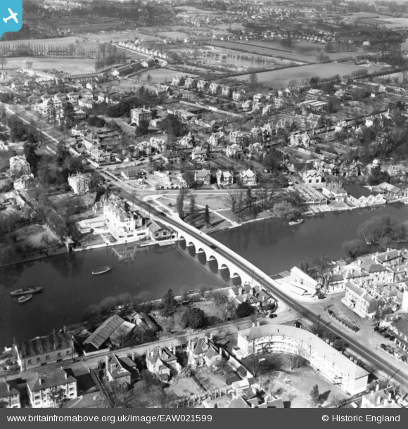
EAW021599 ENGLAND (1949). Maidenhead Bridge and the surrounding area, Maidenhead, 1949. This image has been produced from a print.
© Copyright OpenStreetMap contributors and licensed by the OpenStreetMap Foundation. 2026. Cartography is licensed as CC BY-SA.
Nearby Images (16)
EAW021599

EAW003664

EAW021596

EAW003666

EAW013948

EAW013949

EAW021597

EPW022721

EPW022710

EAW029470

EPW056581

EPW022722

EAW021598

EAW034758

EAW034759

EPW005695

Details
| Title | [EAW021599] Maidenhead Bridge and the surrounding area, Maidenhead, 1949. This image has been produced from a print. |
| Reference | EAW021599 |
| Date | 21-March-1949 |
| Link | |
| Place name | MAIDENHEAD |
| Parish | |
| District | |
| Country | ENGLAND |
| Easting / Northing | 490065, 181392 |
| Longitude / Latitude | -0.70164651930668, 51.523772020754 |
| National Grid Reference | SU901814 |
Pins
Be the first to add a comment to this image!