
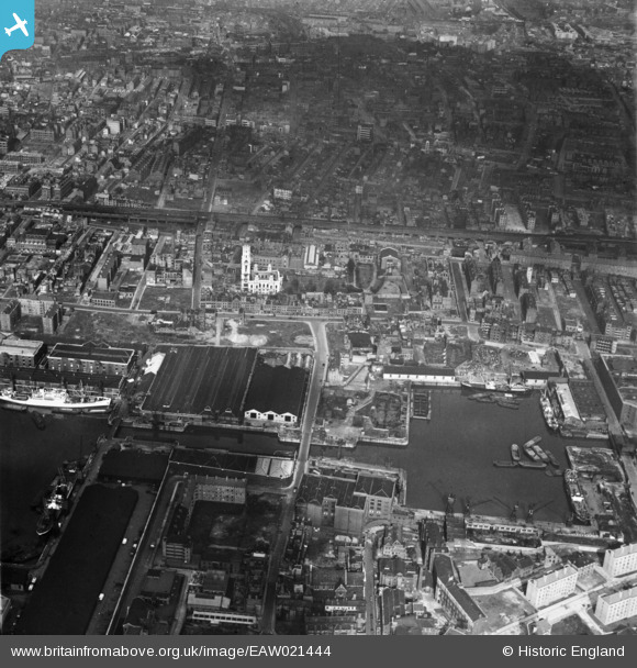
EAW021444 ENGLAND (1949). The London Docks and St George in the East, Wapping, 1949
© Copyright OpenStreetMap contributors and licensed by the OpenStreetMap Foundation. 2026. Cartography is licensed as CC BY-SA.
Nearby Images (4)
EAW021444

EAW110579

EAW022337

EPW044139

Details
| Title | [EAW021444] The London Docks and St George in the East, Wapping, 1949 |
| Reference | EAW021444 |
| Date | 15-March-1949 |
| Link | |
| Place name | WAPPING |
| Parish | |
| District | |
| Country | ENGLAND |
| Easting / Northing | 534803, 180750 |
| Longitude / Latitude | -0.057293503574443, 51.509095165425 |
| National Grid Reference | TQ348808 |
Pins

Robin |
Wednesday 17th of February 2021 03:29:24 PM | |

Class31 |
Sunday 24th of May 2015 08:24:53 PM | |
|
Class31 |
Sunday 24th of May 2015 08:18:26 PM | |

Alan McFaden |
Saturday 11th of January 2014 08:27:10 PM |


