
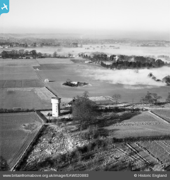
EAW020883 ENGLAND (1949). Fog near the water tower, Little Wymondley, from the east, 1949
© Copyright OpenStreetMap contributors and licensed by the OpenStreetMap Foundation. 2026. Cartography is licensed as CC BY-SA.
Nearby Images (3)
EAW020883

EAW020881

EAW020882

Details
| Title | [EAW020883] Fog near the water tower, Little Wymondley, from the east, 1949 |
| Reference | EAW020883 |
| Date | 2-February-1949 |
| Link | |
| Place name | LITTLE WYMONDLEY |
| Parish | WYMONDLEY |
| District | |
| Country | ENGLAND |
| Easting / Northing | 521540, 227036 |
| Longitude / Latitude | -0.23217722217757, 51.92811938139 |
| National Grid Reference | TL215270 |
Pins
Be the first to add a comment to this image!