
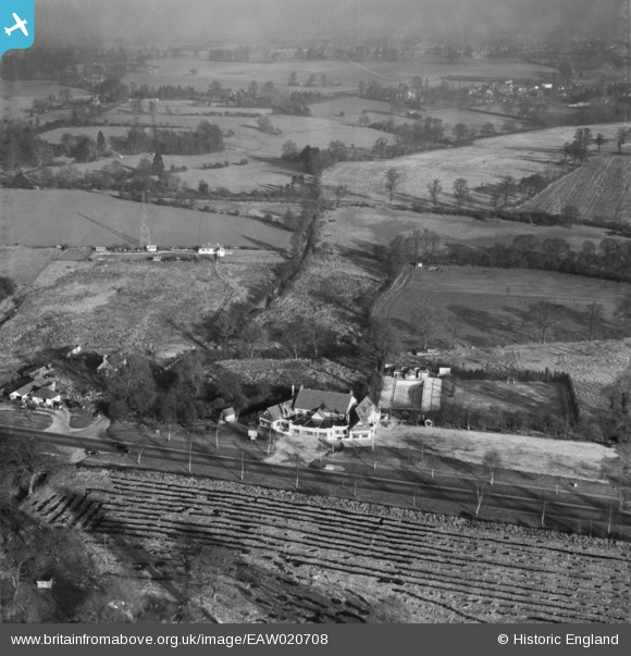
EAW020708 ENGLAND (1948). A camera test image showing the Spider's Web Road House on the North Western Avenue (A41), Bushey, from the south-west, 1948
© Copyright OpenStreetMap contributors and licensed by the OpenStreetMap Foundation. 2026. Cartography is licensed as CC BY-SA.
Nearby Images (15)
EAW020708
, Bushey, from the south-west, 1948")
EPW040469

EAW020712
, Bushey, from the south-west, 1948")
EAW053199

EAW053200

EPW040468

EAW020710
, Bushey, 1948")
EAW029479

EAW020711
, Bushey, from the south-west, 1948")
EAW020716
, Bushey, from the south-west, 1948")
EAW020709
, Bushey, 1948")
EAW020713
, Bushey, 1948")
EAW020717
, Bushey, 1948")
EAW020715
, Bushey, 1948")
EAW020714
, Bushey, 1948")
Details
| Title | [EAW020708] A camera test image showing the Spider's Web Road House on the North Western Avenue (A41), Bushey, from the south-west, 1948 |
| Reference | EAW020708 |
| Date | 23-December-1948 |
| Link | |
| Place name | BUSHEY |
| Parish | |
| District | |
| Country | ENGLAND |
| Easting / Northing | 514238, 196719 |
| Longitude / Latitude | -0.3483237744979, 51.657167979876 |
| National Grid Reference | TQ142967 |
Pins
Be the first to add a comment to this image!